Description
EFFICIENT TOPO – Save Your Office Time
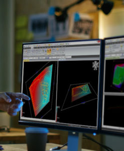
Land Surveying is a competitive industry! We understand that finding ways to increase efficiency and help you save time in the office makes a big difference to the bottom line. MicroSurvey CAD’s “Field to Finish” process allows easy drawing creation directly from fieldwork. Whether you use a total station, GNSS, UAV, scanner or photogrammetry, we can help you turn your data into a deliverable. “AutoMap” is the feature that provides all the customization features you need to process incoming fieldwork. Added flexibility, facilitated by database connected CAD entities, makes fieldwork revisions quick and painless. Since MicroSurvey CAD is an “all in one” CAD and calculations package, you can publish final or interim results directly from your software without exporting to another CAD program for finishing and plotting.
CONSTRUCTION -Everything you Need
The construction surveyor is often the last person to hear about design changes, yet they are required to be the first to implement the changes before machinery arrives. Deadlines come quick, timelines are short, and you need a simple, powerful tool for accurately prepping plans for staking and earthworks. Many companies use MicroSurvey CAD as their primary tool for translating electronic designs into stakes on the ground. Open all commonly used file types from your partners, clients, architects, engineers or designers. Clean up the source and populate your file with points, alignments or surfaces for staking. Easily calculate bolt patterns and pier corners in one step, and auto-compute offsets to prevent rework in the field. When results come back to the office, MicroSurvey has the perfect tool for QA checks, volume reporting, pad building, alignment design and production of your as-built or redline plans. MicroSurvey CAD is the tool you need to help you meet construction deadlines, so you can deliver on time, and keep your clients happy.
CADASTRAL – One Package; Simple Process
Legal land surveyors know that land development projects can take years from start to finish. They can quickly scale up or down depending on factors ranging from changing client requirements, to the rise or fall of the economy. You need a tool that provides solutions for a project of any size, that allows you to quickly and easily make modifications to the plan, adding or subtracting phases with a minimum amount of effort. Whether you are producing a simple right of way plan, or a 150 lot subdivision, MicroSurvey CAD was designed with the tools you need. This all-in-one package allows you to design, exchange field data, perform revisions and produce final plans. There is no need for middleware or an export to another product for traverse calculations, COGO calcs or CAD drafting; MicroSurvey CAD integrates all these functions and stores the relevant data in a single database. Our intuitive, easy to use COGO tools allow you to solve geometry problems and make decisions about evidence with the minimum number of keystrokes and mouse clicks. Smart CAD entities allow you to create points, lines and labels simultaneously so that you are building a document for staking and plan submission at the same time. Lot closure reports are created from your text labels or a printed plan, as they should be, and are simple to produce, allowing you to prove that your labeling is complete and correct to any legislated standard.
FEATURE INDEX – The Features You Need…
Full Standard Features List
- INTEGRATED SURVEY, DESIGN AND CAD
Download, Calculate, Design, Draft, Check and Print – all incorporated into a productive field-to-finish package
- POWERFUL SURVEY, GEODETIC AND GEOSPATIAL DATA ROUTINES
MicroSurvey has the simplest, most productive COGO utility inside a CAD package.
- COMPLETE TRAVERSE OR NETWORK ADJUSTMENTS
Compute Vertical and Angle Balances; Transit, Compass, and Crandall’s Classical Methods, or Least Squares Adjustments.
- ACTIVE DRAWING TECHNOLOGY
MicroSurvey’s Active Drawing Technology is a new and efficient way to work with your survey data.
- CUSTOMIZABLE INTERFACE AND COMMANDS
Completely customizable user interface Toolbars can be arranged with “drag and drop” functionality.
- QUALITY TOOLS FOR EXCELLENT VALUE
Full featured software program for greater efficiency at a lower price. USB Keys available for license flexibility, or network licenses for enterprise functionality.
- COMPLETE SITE DESIGN
Site Design: Compute ponds, ditches, stockpiles and slopes. Road Design: Compute horizontal and vertical alignments, cross section templates
- LEARNING RESOURCES
Microsurvey maintains 12 hours of built-in training movies, equivalent to thousands of pages of documentation.
Learn More: https://www.microsurvey.com/products/mscad/